


Salina 15 Voting District, Sevier County, Utah
About
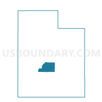
Outline

Summary
| Unique Area Identifier | 679950 |
| Name | Salina 15 Voting District |
| County | Sevier County |
| State | Utah |
| Area (square miles) | 686.91 |
| Land Area (square miles) | 686.67 |
| Water Area (square miles) | 0.24 |
| % of Land Area | 99.96 |
| % of Water Area | 0.04 |
| Latitude of the Internal Point | 38.86511320 |
| Longtitude of the Internal Point | -111.56269340 |
Maps


Graphs
Select a template below for downloading or customizing gragh for Salina 15 Voting District, Sevier County, Utah


Neighbors
Neighoring Voting District (by Name) Neighboring Voting District on the Map
- Aurora 3 Voting District, Sevier County, UT
- Emery 102 Voting District, Emery County, UT
- Ferron 204 Voting District, Emery County, UT
- Koosharem Voting District, Sevier County, UT
- Mayfield Unincorporated Voting District, Sanpete County, UT
- Redmond Voting District, Sevier County, UT
- Salina 14 Voting District, Sevier County, UT
- Salina 25 Voting District, Sevier County, UT
- Sigurd Voting District, Sevier County, UT
- Unpopulated Voting District, Emery County, UT
Top 10 Neighboring County Subdivision (by Population) Neighboring County Subdivision on the Map
- Richfield CCD, Sevier County, UT (11,195)
- Ephraim-Manti CCD, Sanpete County, UT (10,982)
- Salina CCD, Sevier County, UT (4,705)
- Emery-Ferron CCD, Emery County, UT (2,330)
Top 10 Neighboring Place (by Population) Neighboring Place on the Map
Top 10 Neighboring Unified School District (by Population) Neighboring Unified School District on the Map
- Sevier School District, UT (20,802)
- South Sanpete School District, UT (16,448)
- Emery School District, UT (10,976)
Top 10 Neighboring State Legislative District Lower Chamber (by Population) Neighboring State Legislative District Lower Chamber on the Map
- State House District 73, UT (34,070)
- State House District 70, UT (34,036)
- State House District 69, UT (31,813)
Top 10 Neighboring State Legislative District Upper Chamber (by Population) Neighboring State Legislative District Upper Chamber on the Map
Top 10 Neighboring 111th Congressional District (by Population) Neighboring 111th Congressional District on the Map
Top 10 Neighboring Census Tract (by Population) Neighboring Census Tract on the Map
- Census Tract 9751, Sevier County, UT (4,705)
- Census Tract 9725, Sanpete County, UT (4,578)
- Census Tract 9765, Emery County, UT (3,462)
- Census Tract 9752, Sevier County, UT (2,757)